


Ruta de A Picaraña - PRG 30
This 6.9-km circular route is of low difficulty due to the few stretches of uneven ground and because the well-marked signs make it very easy to follow.
Services
- Paneles informativos: Sí
- Seguro para niños: Sí
Access
Access description There is an asphalt road leading to the convent of Canedo, where the hiking route begins. Signposting description Follow signs for the convent of Canedo, where a sign indicates the starting point of the route.- Los accesos al recurso están adaptados para personas con discapacidad: Sí
- ¿Existe transporte público para acceder al recurso?: Sí
- Accesos a pie: Sí
- Accesos para vehículos privados: Sí
Features
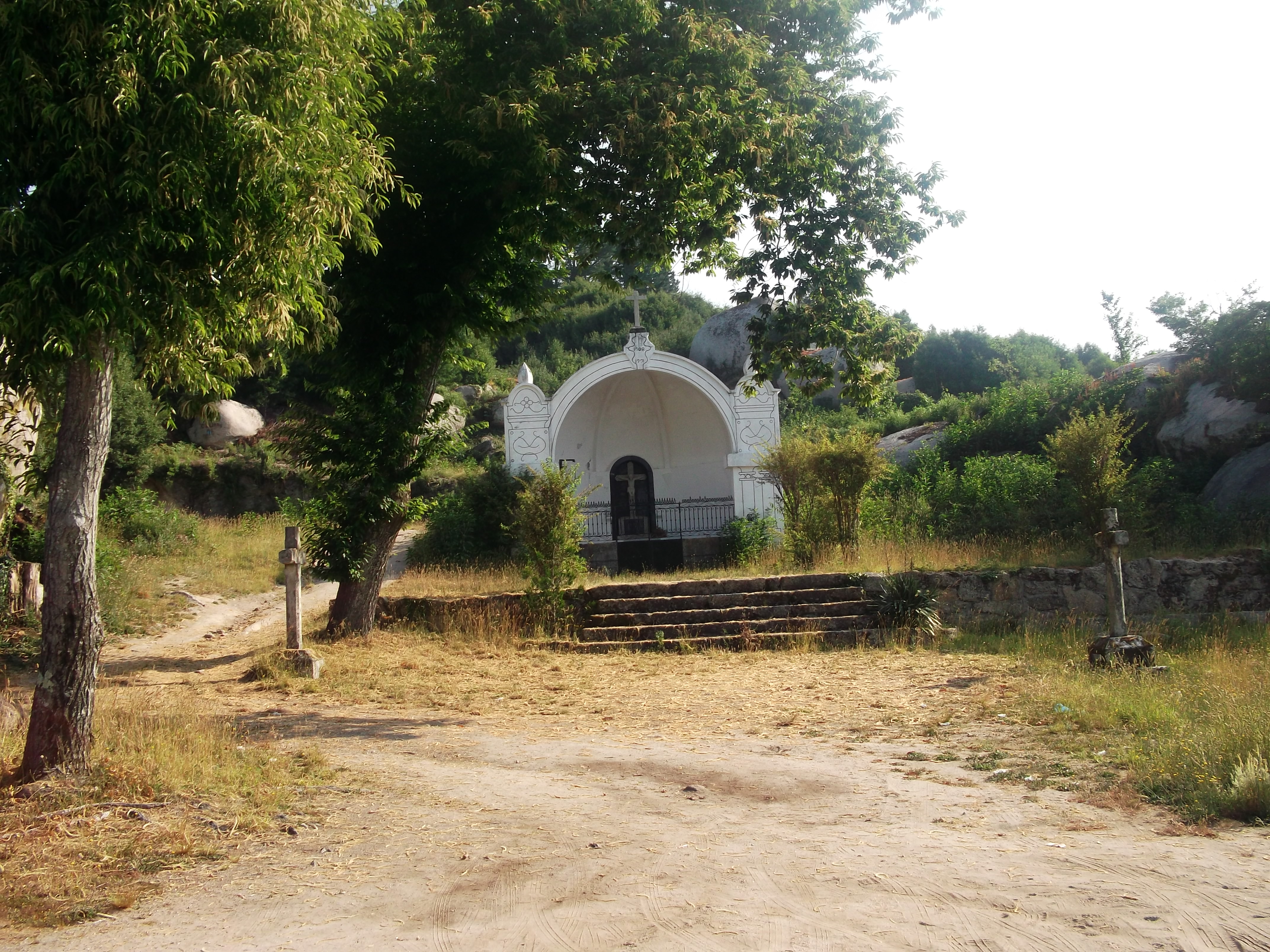
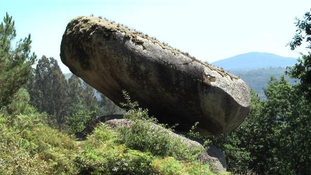
Native terrestrial flora and fauna Forests of pines, eucalyptus and shrubs near the chapelPlaces of interest along the route Piedra del Equilibrio (rocking stones), youth hostel near a weeping willow, church of Santa Cruz, convent of Canedo Connections It links with the PRG-120 route of Penedos da Picaraña.
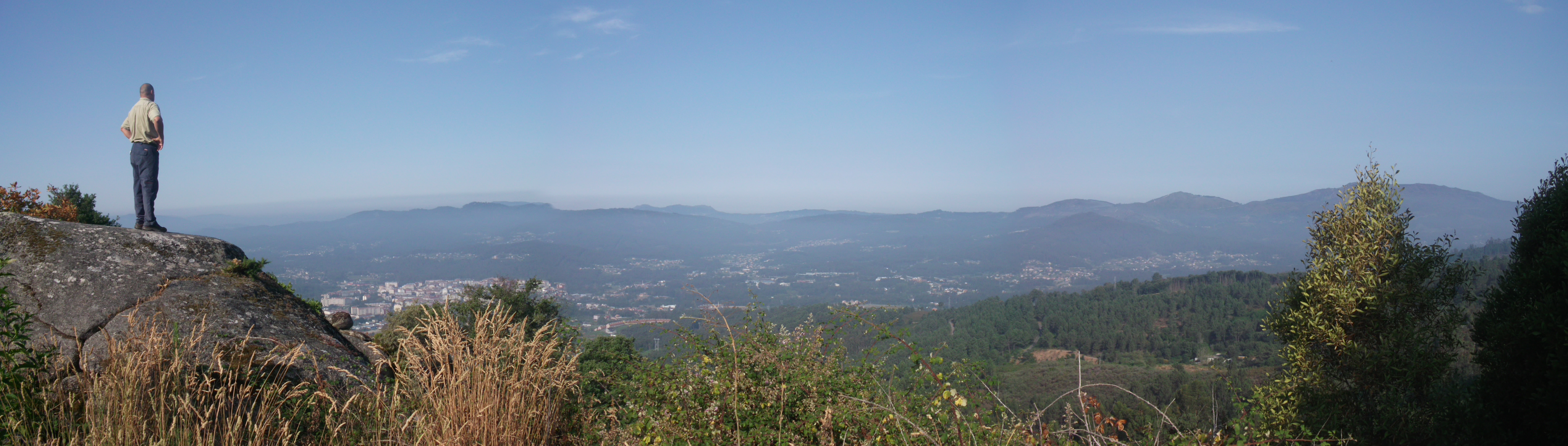
Starting point and destination The route starts and ends in the convent of Canedo. Description of the route The route starts next to the stairs of the convent of Canedo, where there is an information panel to the right. The trail leads to Piedra del Equilibro, a set of rocking stones worthy of a visit. After the youth hostel there is a beautiful weeping willow. Following the trail, the chapel of Santa Cruz can be found. It dates from 1907, when a romería (a religious festival) began to be celebrated every first of May. The chapel is the highest point of the trail and it offers incredible panoramic views of Ponteareas. After this, the trail leads to the convent of Canedo again. Recommended material Comfortable clothes and footwear suitable for hiking Cartography of the National Geographic Institute (IGN) 1:25.000. 224-III Ponteareas
- Itinerario (M.I.D.E): 2
- Desplazamiento (M.I.D.E): 2
- Esfuerzo (M.I.D.E): 2
- Medio (M.I.D.E)
- Description of the surroundings: Mountainous
- Duración (horas): 2
- Responsible body: Council of Ponteareas
- Tipología del Recorrido: Circular
- Interés Paisajístico: High
- Dificultad : Low
- Estado de la señalización: Very good
- Sombra: Sí
- Access on foot, by bicycle, on horseback, by motorcycle, by private vehicle
- Tipología de la ruta: Natural
- Estado de Conservación: Very good
- Duración (minutos): 45 minutes
- Length: 6,9 km