DÉCOUVRIR
Costa da Vela
Rúa de Fóra, s/n, Santo André de O Hío
36945 Cangas de Morrazo Pontevedra
Spain
Teléfono


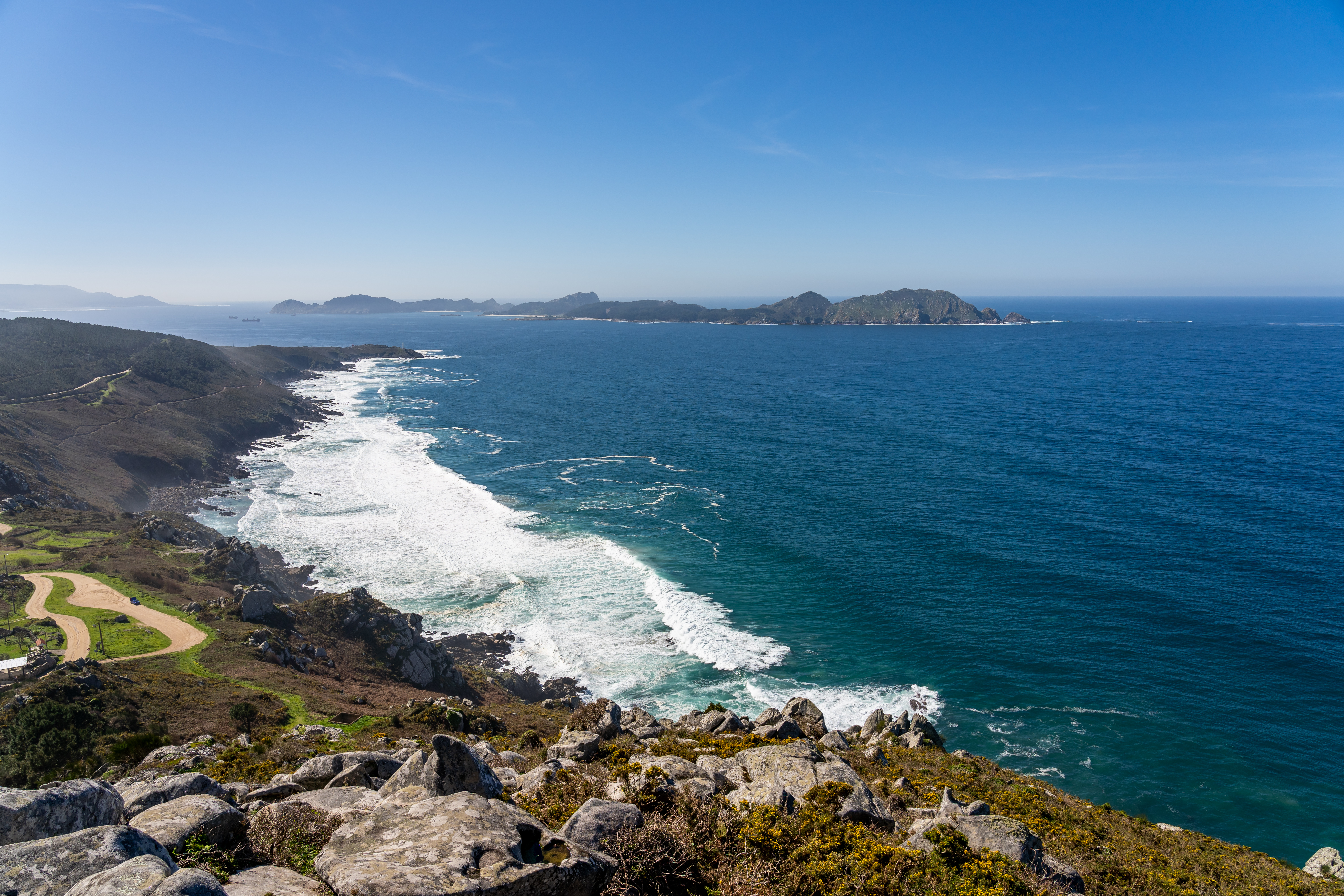
This area is located between the rías (estuaries) of Vigo and Pontevedra, at the westernmost point of the peninsula of Morrazo. It comprises the sandy areas of Nerga, Viñó and Barra, with dune systems and pine forests. It also has over 150-metre high cliffs stretching from the lighthouse of Cabo Home to Punta Couso and Monte do Facho, and an old castro (hillfort settlement) and sanctuary located 160 metres above sea level. It is an excellent natural viewpoint over both estuaries.
Transports le plus proche:
Ville la plus proche:
Vigo
En savoir plus sur


Cangas de Morrazo
Notez cette ressource
- Image

- Image

- Image
- Image
A payer
Accès gratuit
Chiffres de protection
Zone protégée Réseau Natura 2000 - Site d'importance communautaire (SIC)
Parking
Oui, gratuitement
Organisme responsable
Concello de Cangas
DImensions
1419 ha
Intérêt paysager des environs
Surélevé
Description de l'environnement
Avec vue panoramique
Signalisation
Adéquat
État de conservation
Excellent
Autres services
Playas