DÉCOUVRIR
Ruta de los ríos Freixeiro y Souto
- Image


Rio Freixeiro-Souto, San Mamede de Abalo
36612 Catoira Pontevedra
Spain
Teléfono
En savoir plus sur


Catoira
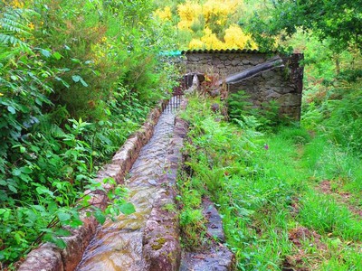
This trail offers the possibility to get to know the essence of the Galician landscape: quiet streams of clean water where to find century-old mills, soft meadows next to the water and dense oak and eucalyptus woods, hiding natural promontories rising over the sea and the ría in the horizon.
Transports le plus proche:
Ville la plus proche:
Vilagarcía de Arousa
Notez cette ressource
Typologie de l'itinéraire
Circulaire
La durée
2
Longueur totale (km)
10,7 km
Intérêt paysager des environs
Surélevé
Description de l'environnement
Montagneux
Difficulté
Haut
Itinéraire (M.I.D.E.)
5
Déplacement (M.I.D.E.)
4
Effort (M.I.D.E.)
2
Moyen (M.I.D.E.)
2
État de conservation
Besoin de réadaptation
Organisme responsable
Concello de Catoira
Matériau recommandé
Se recomienda llevar calzado cómodo, ropa cómoda y ligera y una mochila con agua y ropa de abrigo