Via Mariana
A path of faith, nature and culture
Embark on a unique experience on the Via Mariana, a pilgrimage route that will take you through the most emblematic landscapes of the interior of the province of Pontevedra. This route, which connects sanctuaries dedicated to the Virgin Mary, is much more than a simple journey; it is an invitation to discover the rich cultural and natural heritage of Galicia.

Sanctuary of A Virxe da Franqueira
Marian devotion predates the Jacobean devotion. It belongs to the intangible heritage of Galicia. But it is also part of the essence of the people of northern Portugal.
The beautiful route begins in the north of Portugal until it crosses the Miño River, following its spectacular journey through Arbo, A Cañiza, Mondariz, Covelo, Fornelos de Montes, A Lama, Ponte Caldelas, Cercedo-Cotobade, Campo Lameiro, Moraña, Cuntis, Valga and Pontecesures. From there, the route continues to the sanctuary of Nuestra Señora de la Virgen de la Barca, in Muxía, but not before passing through the cathedral of Santiago de Compostela.

Petroglyphs of Campo Lameiro
Distance: 16.6 km
After crossing the border and leaving behind the Arbo-Melgaço International Bridge, we continue our adventure along a river path along the banks of the Miño River to enter the interior of the province of Pontevedra.
Arbo is famous for its delicious lamprey, its natural landscapes and its famous Albariño wine cellars.

River walk in Arbo
In this stage, the beauty of the landscape is combined with the rich cultural tradition of the region. The route takes you along paths surrounded by native forests and monuments where time seems to have stood still. It is an opportunity to disconnect and immerse yourself in the tranquillity of Galician nature.
Distance: 21.7 km
The route takes us through the Fragas del Río Calvo, a dense forest full of life. We continue climbing towards the Coto da Vella viewpoint, a charming spot overlooking the valley, before arriving at the Sanctuary of Nosa Señora da Franqueira.
Every year, the municipality of A Cañiza becomes the epicentre of a celebration full of fervour and tradition: the Pilgrimage of Our Lady of Franqueira. This event, which is held on Whit Monday and 8 September, attracts thousands of pilgrims and visitors who are captivated by the devotion and charm of this festivity.

Pilgrimage of Our Lady of Franqueira
Its antiquity, together with the devotion of thousands of Galicians and pilgrims from the north of Portugal and the particularity of the pilgrimage, were aspects considered to declare it a Festivity of Tourist Interest in Galicia.
Distance: 26.8 km
The stage begins in Santiago de Covelo, an ideal starting point for exploring the region. Here, pilgrims can admire the cruceiro and the rectory of Santa Mariña de Covelo, two outstanding examples of the local architectural heritage.
In Casteláns, the ruins of the Monastery of Santa María de Casteláns offer a fascinating insight into local history, while the Church of Santo Estevo de Casteláns is a testimony to the religious heritage that characterises the area.
The next section takes visitors to Barciademera, crossing the Ponte do Río Caraño. On arrival, you can visit the church of San Martiño de Barciademera and its rectory house, places that offer an opportunity to enjoy religious architecture in a peaceful rural setting.

San Martiño de Barciademera
The route continues towards Ponte de Talaveira and the village of Sabaxáns, in Mondariz. Then, at San Xoán do Mosteiro, there is a group of mills, a cross, a chapel and the Casa da Inquisición, which offer a rich cultural experience.
Further on, the route passes the Pozas do Mosteiro, a natural site of outstanding beauty, and continues along a forest road towards Fornelos de Montes. Here, pilgrims can explore the Chan da Anduriña Archaeological Area before ending the stage in the parish of Santa María de Estacas.
Distance: 25.8 km
The route starts in Santa María de Estacas, in Fornelos de Montes, and follows the Camino de Difuntos to the Pontella del Río Couñago and the Ponte Anceu, offering views over the Río Parada.
In Ponte Caldelas, San Fiz de Forzáns stands out with its Muiño de Barreiras and the Camiño da Xesteira. Next, the route passes through Santa María de Caritel, before entering the Pasos del Río Pequeño and the Pasos da Fraga over the river Verdugo. This section offers unique hiking experiences, including the Sendeiro do Foxo do Lobo and the Muiños de Calvelle. In A Lama, the Variante de Invierno is an alternative when the Verdugo River is swollen, offering a detour through A Larpea.

Verdugo River
The Sanctuary of Aguasantas in Cotobade is a highlight. The Santuario do Libramento in San André de Valongo is another site of interest, followed by Cubelas. The route continues to Santiago de Loureiro and the village of Arufe, culminating in San Blás (Rebordelo) and the A Chan-Carballedo river beach.
Distance: 24.7 km
The stage begins in Cotobade, in the town of A Chan, and heads towards San Roque, passing the church of San Miguel de Carballedo. From there, the route advances through Trabazo and the Alto de Coiregos. You then reach Vila de Arriba, which has a traditional cruceiro (stone cross), and continue towards Santa María de Sacos. Here, care should be taken when crossing the main road, especially if the usual access is overgrown.
The route continues towards the Estación Arqueológica do Outeiro, with the option of turning off towards the Carballeira and the Baños de San Xusto.

Petroglyphs of Outeiro
Continuing parallel to the road, we reach the Pazo Bermúdez de Castro and San Xurxo de Sacos. Then, we cross the river Lérez by the Ponte de San Xusto and arrive at Fentáns. The stage ends in Campo Lameiro, with the option of a detour to Praderrei, offering a route that combines archaeological heritage, such as the petroglyphs, with the beauty of the landscape.
Distance: 21.7 km
The stage begins in Campo Lameiro, famous for its prehistoric petroglyphs, which represent one of the most outstanding sets of rock art in Galicia.

Petroglyphs of Campo Lameiro
The route continues to the Sanctuary of the Virgen de los Milagros de Amil, an important pilgrimage site known for its popular annual pilgrimage. Afterwards, the route heads to Moraña, where you can see historical monuments such as the Castro de Paraños and the Menhir de Gargantáns, which reflect the rich ancestral history of the region.

Gargantáns Menhir
The stage concludes in Cuntis, a place renowned for its thermal waters and spa, offering pilgrims the opportunity to relax and enjoy their therapeutic properties.
Distance: 20.5 km
The stage begins in Cuntis, where the route starts at the church of Santa María dos Baños. From here, the route advances towards the Pereira Convent, passing through Transponte and crossing the river Calvos. The route continues towards the Petroglyphs of O Forno da Tella and Outeiro dos Mouchos, where ancient rock engravings can be seen.
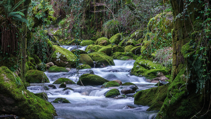
Following the path, you pass through Xirei, Noval and Vilariño until you reach A Bragaña, where there are options to rest and enjoy a meal in a local tasca. The route then leads to Alto da Bragaña, from where you can take a detour to the pilgrims' hostel in Valga, passing through As Ribocias and As Cernadas before returning to the main path via the Fervenzas de Raxoi trail.

Fervenzas de Raxoi
The route continues towards Mágán and then on to the chapel of Santa Lucía. At this stage, it is recommended to visit the sanctuary of Os Milagros de Requián, a diversion of approximately 2.5 km. Back on the main route, continue along an asphalted forest track, passing Fonte da Abella and Regato Ferreño, and arrive at the Os Martores area.
The route continues towards the chapel of San Mamede, crosses the river Valga, and climbs through As Laceiras towards Alto dos Salgueiros. It then descends through Fenteira, Confurco and Morono before reaching A Rocha and A Barca, in Pontecesures. Finally, it crosses the river Ulla to finish the route through the province of Pontevedra and reach Santa María de Herbón and the Monastery of San Antonio de Herbón.