


Río Umia
The Umia River starts near the O Candán Mountains in the parish of Aciveiro, municipality of Forcarei, and flows through the municipalities of A Estrada, Cuntis, Moraña, Caldas de Reis, Portas, Meis, Ribadumia and Cambados, creating a basin of 404 km². It ends at the estuary of Arousa in the parish of Barrantes, bordering the peninsula of O Grove. It flows into the Meridian Depression in Caldas de Reis, and then ends between the municipalities of Cambados and Ribadumia, creating marshes in the estuary where many migratory animals can be seen throughout the seasons. The river has been of great cultural significance over the course of history.
Access
- Los accesos al recurso están adaptados para personas con discapacidad: Sí
- Accesos a pie: Sí
Servicios
- Navegación y fondeo: Sí
- Permitido el baño: Sí
- Observatorio de Aves: Sí
Features
Native aquatic flora and fauna The aquatic flora and fauna of the river consists of algae, sea lettuce, knotted kelp, trout, bogue, lamprey and salmon. Responsible body Augas de Galicia from the Xunta de Galicia (Galicia’s regional government) Native terrestrial flora and fauna Vegetation includes the water-starwort, buttercup, reed, bulrush, duckweed, floating pondweed and water dropwort. Fauna consists of several migratory species. Located in Aciveiro (municipality of Forcarei) – Estuary of Arousa- Interés Paisajístico: High
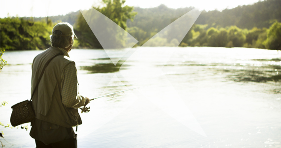
Sport or underwater fishing
- Pesca deportiva o submarina: Sí
- ¿Se necesita licencia?: Sí