


Estuario del río Ulla

Catoira (San Miguel)36612 CatoiraPontevedra
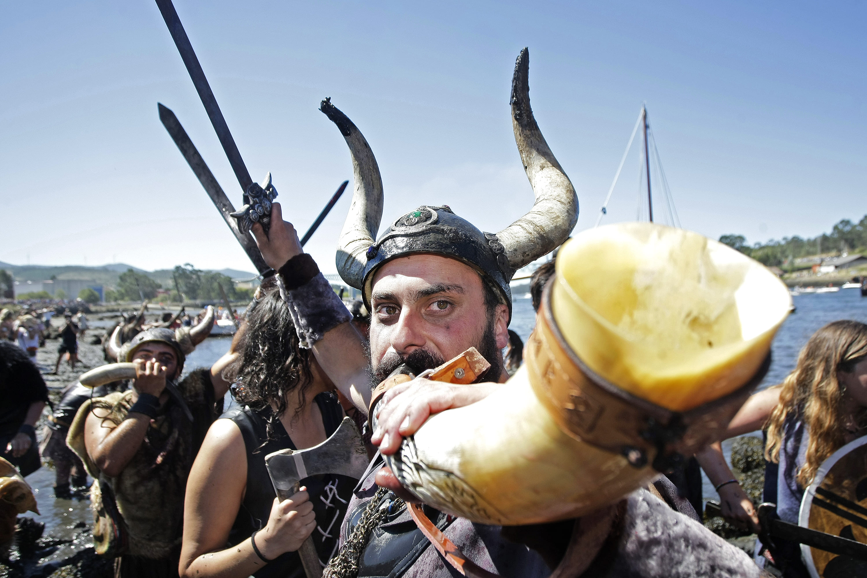
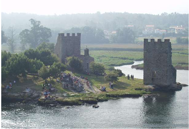
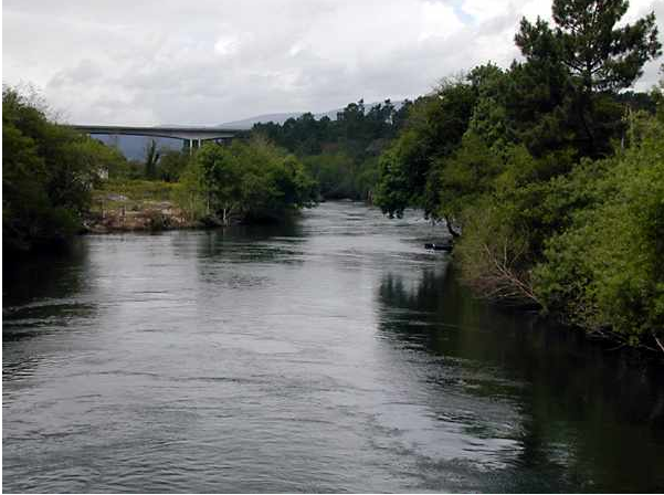
From its source in the Lugo area of A Ulloa to its mouth in the Ría Arousa, the River Ulla runs approx. 132 km and drains a basin of 2,803 km². The final 15 km from Pontecesures can be navigated up to its mouth in the Ría Arousa. It is the third-longest river in Galicia after the Miño and the Sil, and serves as the provincial border between A Coruña and Pontevedra. The estuary marks the northern and western edge of the territory, bordering Vilagarcía de Arousa and Vilanova de Arousa to the south-east. The Torres de Oeste castle is located at this strategic point of the estuary, in Catoira. It's perfect for doing aquatic sports. It's an annual tradition to row upriver from Villagarcía de Arousa to Pontecesures on the Maritime Route of Mar de Arousa and Ulla, one of the routes to Santiago
Access
- Accesos para vehículos privados: Sí
- Accesos a pie: Sí
Features
Native aquatic flora and fauna Place of refuge for many aquatic birds. As well as trout and lamprey, the River Ulla is mainly home to salmon Native terrestrial flora and fauna The estuary formed by the mouth of the River Ulla in the Arousa ría is an extremely important environmental area. Rushes and reedbeds are very abundant here, which is why the zone forms part of the Natura 2000 Network. You will find the most extensive reedbeds in Galicia on this section, which starts at the Laiño brañas (fields) and ends at the brañas of Oeste. The island of Cortegada is one of the gems of the Ulla estuary. The biggest laurel forest on the Iberian peninsula is located here - it is extremely well-preserved, with trees reaching up to 12 m in height. Various birds including herons and cormorants can be spotted here- Pesca deportiva o submarina: Sí
- ¿Se necesita licencia?: Sí
- Description of the surroundings: River
- Located in: Catoira
- Interés Paisajístico: High
- Responsible body: Xunta de Galicia
- Opening dates: Free visit
Services
- Merendero: Sí
- Navegación y fondeo: Sí
- Permitido el baño: Sí