A paradise step by step

Rías Baixas offers incomparable hiking trails along the coast and inland

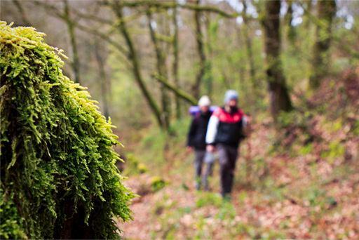
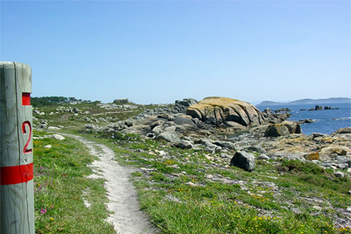
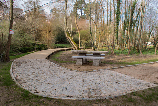
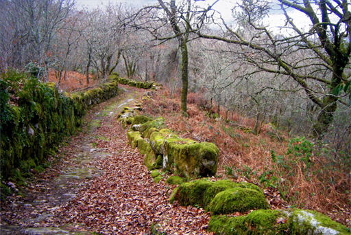
The best way to be immersed in As Rías Baixas is to walk through it step by step. This land offers hiking trails for everyone, so you can discover it if you do hiking as a hobby, to enjoy the scenery or if you want to enjoy it as a sport.

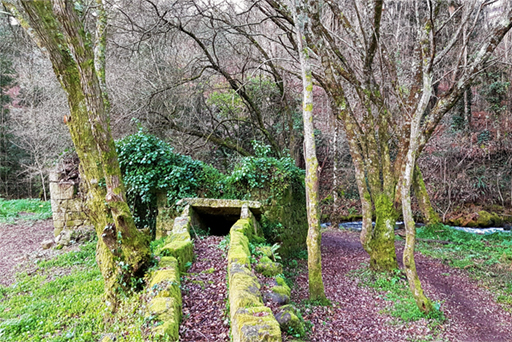
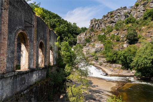
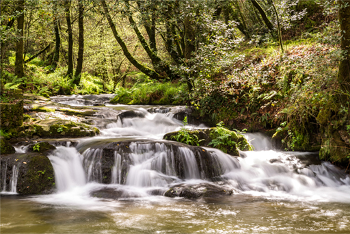
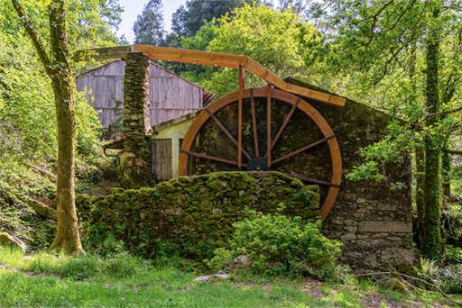
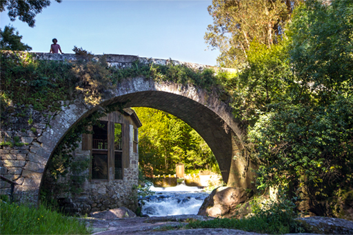
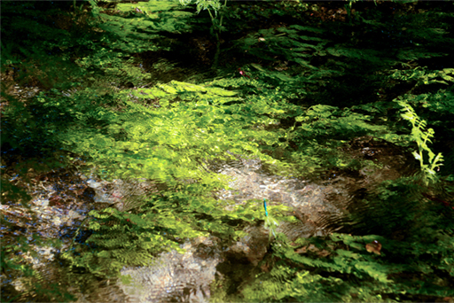
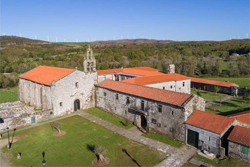
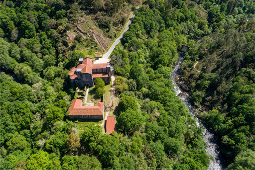
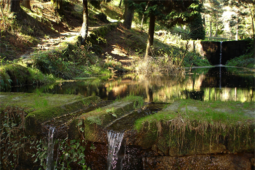
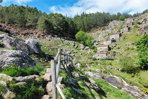
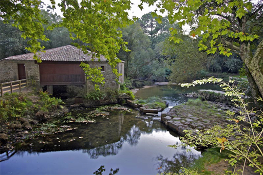
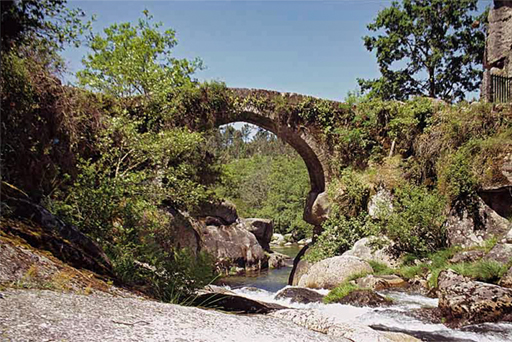
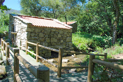
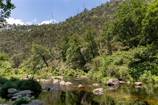
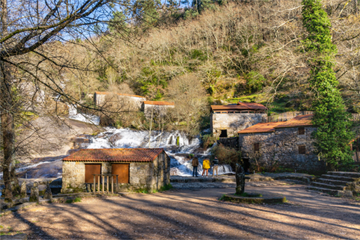
On the banks of rivers and streams, you will find magnificent riverside forests with native plants. Ancient mills, vestiges of a past way of life, welcome the visitor now perfectly restored, as well as traditional fountains and washing places. In the province of Pontevedra, nature and heritage are combined.

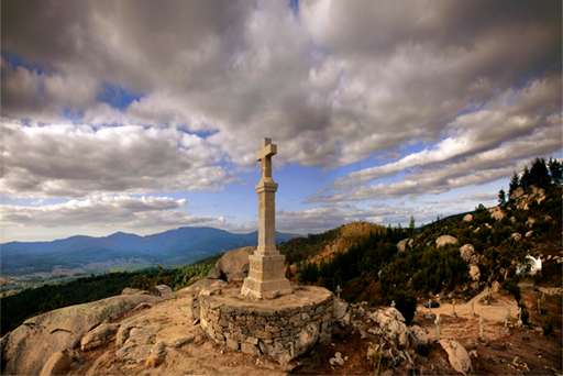
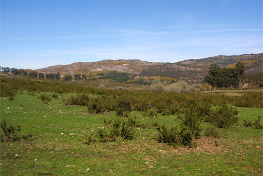
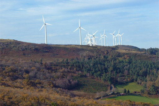
When you walk among oak trees and centenary chestnut trees, you will feel in harmony with the environment. Hills, forests and woods hide a world of sensations, and boast interesting flora and fauna that you will find through the endless paths of this land.

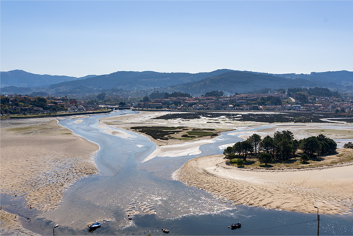
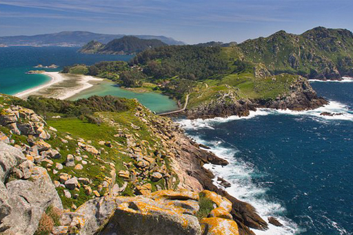
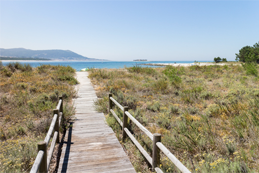
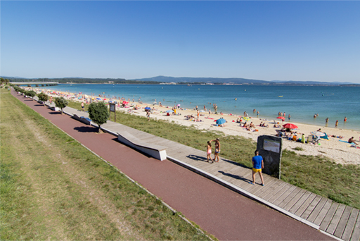
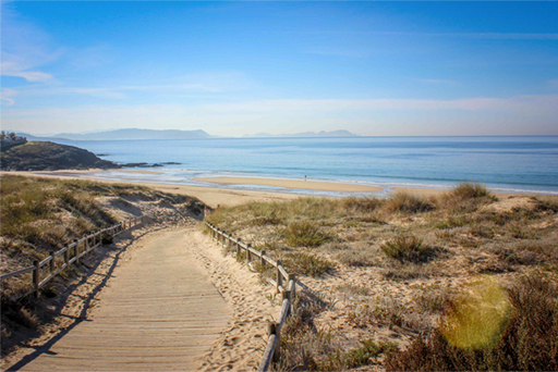
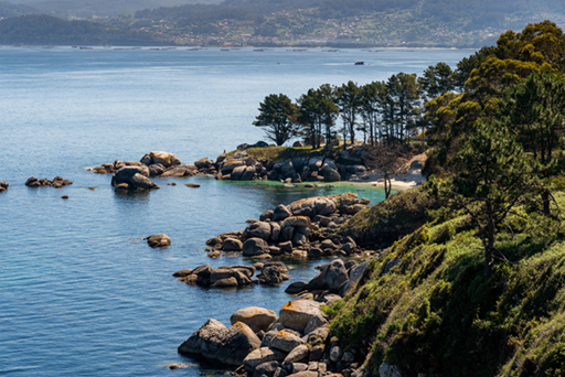
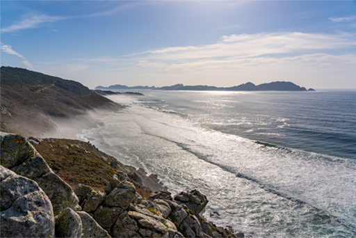
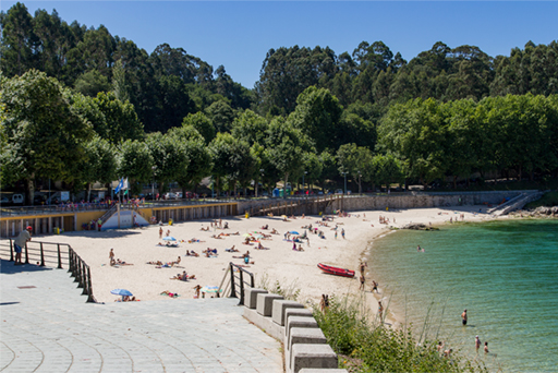
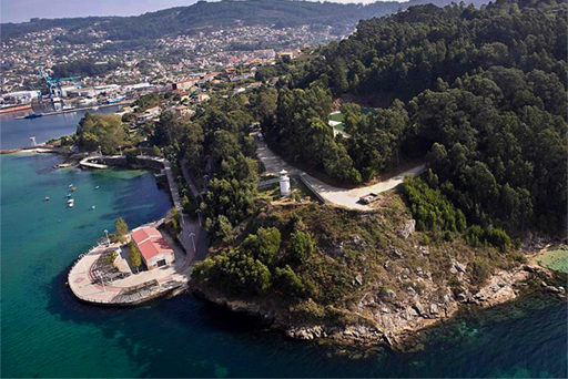
As Rías Baixas coast is breathtaking. Along its 300 kilometres of coastline, you will find 55 blue flag beaches, breathtaking cliffs, impressive capes with majestic lighthouses, beautiful coves and bays, and charming fishing villages that still preserve their architecture and customs.

A whole world of trails is waiting for you. Come and discover them!


Mapa senderos
imagen-sendero
Sendero Azul del litoral de Baiona
Baiona
42.113909, -8.818653
6
km
This 6-km coastal trail connects A Concheira Beach and the natural site of A Foz do Miñor. There is a plethora of flora and fauna along the way, as well as hotels, lookouts and rest areas suitable for people with mobility issues. The route includes paths through the hill of Monte Boi, all the sandy areas of the municipality and the marinas. They are also connected with the river path of Baíña and the bird observatory of A Foz.
imagen-sendero
Sendero de A Fraga
Moaña
42.313736, -8.725744
15
km
This hiking trail has a rich ecological value and is the most appealing route in Moaña, attracting many walkers. It runs along A Fraga River, also known as Os Ladróns River. It rises in A Fraga (one of the highest spots in Moaña), and flows into A Xunqueira, situated in the lower part of Moaña, next to the beach. As you climb higher, you will find some water mills (around 30 in total), as well as farmed land, granaries, and typical Galician rural houses at the top. There are also some pools perfect for bathing.
imagen-sendero
Sendero Azul entre faros, islas Cíes
Vigo
42.212272, -8.91248
12
km
The Cíes archipelago comprises the islands of Monteagudo, Faro and San Martiño. They are part of the Atlantic Islands Maritime-Terrestrial National Park, along with the archipelago of Ons, Sálvora and Cortegada. This route uses two existing trails: that of Faro de Cíes and Faro do Peito. They both provide a broader view of the richness of the area. It passes through the Rodas Beach (which is considered the best beach in the world), its dunes, the lake Lago dos Nenos, the visitors centre of the national park, the dunes of Muxieiro-Figueiras, the Figueiras Beach and a bird observatory.
imagen-sendero
Senda río Umia - Segade
Caldas de Reis
42.606323, -8.8623125
6,3
km
The route starts in the park of Caldas de Reis, with its stunning oak grove and the botanical park. The trail runs along the left bank of the river, in the middle of nature, passing by cascades and bridges up to the cascade of Segade, one of the most beautiful in As Rías Baixas. In the surroundings is the former light factory, the industrial symbol of Caldas.
imagen-sendero
Ruta da Pedra e da Auga
Ribadumia
42.493525, -8.773752
6,35
km
It is a group of water mills, built in 1700 on the left bank of the Armenteira River, in Serén. These were the main facilities of the flour industry, used to mill different types of grain and cereal. Today, it has become a picturesque site combining traditional culture with a unique landscape.
imagen-sendero
Sendero de Os Carranos
Covelo
42.276039, -8.35241
7
km
The name of the route comes from the name of the hydraulic sawmill of Os Carranos. The riverside woods at the source of the river Tea are one of the main attractions of this route. The itinerary starts in the old rectory of Fofe and heads to the recreational area of the Maceiras Beach.
imagen-sendero
Sendero de As Fragas e Levados dos ríos Calvo e Deva
A Cañiza
42.17909, -8.301995
16,45
km
This route leads to magical medium mountain areas hiding the mysteries of the rivers Calvo and Deva. There, visitors can explore forgotten paths, charming places full of history and unique spots with mills, cascades, pools and ponds.
imagen-sendero
Ruta de A Picaraña
Ponteareas
42.18169, -8.491704
6,9
km
This 6.9-km circular route is of low difficulty due to the few stretches of uneven ground. Moreover, the well-marked signs make it very easy to be followed.
imagen-sendero
Ruta de O Xabriña
Covelo
42.204105, -8.386904
16,5
km
The Xabriña River, one of the tributaries of the Tea River, is the main attraction of this 17-km long route. The route perfectly combines natural values with the rich ethnographic heritage of the area.
imagen-sendero
Ruta de los Molinos de Gargamala
Mondariz
42.261303, -8.448279
11,69
km
Route of the mills surrounded by a beautiful natural landscape and with interesting spots along the trail. It has places to rest and shaded picnic areas.
imagen-sendero
Ruta de los Puentes del Lérez
Forcarei
42.617561, -8.301554
13,8
km
The trail starts in the beautiful monastery of Santa María de Aciveiro and runs along the bank of the Lérez River in its first stretch until the village of Gaxín. The trail crosses the medieval bridge of Andón towards Pico Valiñas, and then goes back to the bank of the river at the A Carballa Bridge. On their way, hikers will have the opportunity to enjoy an interesting riverside forest and cross the bridges of O Crego, Maril, Ponte Vella and Nova.
imagen-sendero
Sendero Circular de Agua de Parada
Silleda
42.714814, -8.268088
6,7
km
This group of fountains and washing places creates the most typical landscape of rural Galicia, with green fields, farmhouses and small animal farms. They are a clear example of the significance that water used to have in the everyday life of the locals.
imagen-sendero
Sendero Circular de Zobra
Lalín
42.568237, -8.202992
18,9
km
A circular trail that passes through the parish of Zobra. If you do it by bicycle, the difficulty increases due to the steep slopes. It can also be done in motor vehicle (mountain bike or quad).
imagen-sendero
Sendero del Deza
Vila de Cruces y Silleda
42.766762, -8.273747
6
km
This route starts at the cascade of the Toxa River and runs downstream until it reaches the mouth of the Deza River. The trail passes through an iron bridge leading to the church of San Paio and to the town of Merza. After the river beach of A Carixa, there is a fairly difficult climb to the right towards the town of A Portela, although the shortest way would be to continue up the road towards the spa of Baños da Brea and then to the old path to Carboeiro.
imagen-sendero
Sendero Azul del litoral de A Guarda
A Guarda
41.873188, -8.871288
5,6
km
This coastal route allows us to explore the coast of A Guarda from the port to the mouth of the Miño River, ending at the beach of O Muíño. It is a 3.6-km trail for pedestrians, and bikes can be ridden up to the middle section. It offers views of the beautiful coastline and the grandeur of the ocean.
imagen-sendero
Ruta de O Monte Aloia
Gondomar, O Porriño, Tui
42.081406, -8.669686
9
km
It passes through the hillsides of the Serra do Galiñeiro, crossing forested areas with excellent views of the coastal inlet Ría de Vigo, the Val Miñor and O Miño Baixo. The route passes by areas of archaeological interest until it reaches the Aloia Hill, declared a Natural Park in 1978, the first in Galicia.
imagen-sendero
Ruta de los Molinos do Folón e do Picón
O Rosal
3,5
km
Group of 60 hydraulic mills from the 17th and 18th centuries, declared a Site of Cultural Interest in 1998. They are divided into two distinctive sections: • Muíños do Folón: 36 mills along the Folón River • Muíños do Picón: 24 mills along the Picón River.
imagen-sendero
Sendero de los Pescadores Río - Tamuxe
O Rosal
41.921461, -8.78402
7,2
km
This hiking trail, which is suitable for families, runs along great sandy areas and offers impressive panoramic views of the estuary of the Miño River.
imagen-sendero
Sendero Azul Perimetral Bao - Xastelas
A Illa de Arousa
42.543704, -8.868257
2,5
km
This coastal trail runs through the south-eastern part of A Illa de Arousa and connects O Bao Beach with the natural site of O Carreirón. There is a great variety of beaches along the way with different shapes, outlines and slopes, most notably half-moon beaches. There are also many different ecosystems, marshes and rocky areas of rich landscape value.
imagen-sendero
Red de Senderos Azules de Sanxenxo
Sanxenxo
42.397556, -8.81636
25
km
The Sendeiros Azuis (Blue Trails) play an important social role, being excellent places for enjoying nature and also valuable elements for the development, health and well-being of the society as a whole. Sanxenxo has the following trails connecting beaches distinguished with a Blue Flag: Sendeiro Máxico da Lanzada, Sendeiro Magor–Montalvo, Sendeiro Montalvo– Paxariñas, Sendeiro Canelas–Punta Cabicastro, Sendeiro Sanxenxo–Portonovo, Sendeiro Areas–Punta Festiñanzo.
imagen-sendero
Sendero Con Negro - Arte Natural
O grove
42.466727, -8.936648
3.8
km
This coastal trail boasts one of the best preserved and most spectacular spaces on the O Grove Peninsula. It has isolated beaches, surrounded by an unspoiled natural environment that is worth visiting. It is an area with a rich coastal wildlife. It is part of the network Natura 2000.
imagen-sendero
Sendero Azul de Cabo Udra
Bueu
42.321961, -8.825712
4
km
This route runs through the west coast of the municipality of Bueu, where the headland of Cabo Udra marks the end of the Aldán Bay and the beginning of the coastal inlet Ría de Pontevedra with several rocky coves. The panoramic views over the coastal inlet Ría de Pontevedra and the Tambo Island are stunning from the peak of this headland (at 91 m) and from the hill of Carafixo (at 129 m). The main attractions of the route can be found along the coast of Cabo Udra.
imagen-sendero
Sendero Azul de Donón
Cangas do Morrazo
42.270821, -8.860795
12,5
km
This route starts at the famous sculpture Caracola de Donón, by Lito Portela, and descends to the dunes and the Barra Beach towards the lighthouse of Punta Subrido, which offers excellent panoramic views of the coastal inlet Ría de Vigo and the Cíes Islands. Punta Robaleira is worth a visit, as well as the cliffs facing the open sea in Costa da Vela. The trail is part of the Sendeiros Azuis (Blue Trail Network).
imagen-sendero
Red de Senderos Azules de Marín
Marín
42.390061, -8.714808
8,5
km
This is a route of great beauty that connects several itineraries boasting Blue Flag beaches or ports, which contribute positively to the sustainable use of the coastline. It comprises the following sections: Route of the Beaches, Route of the Five Viewpoints and Route of Hills and Beaches.
imagen-sendero
Sendero Azul del litoral del monte de A Guía
Vigo
42.255554, -8.701816
6
km
This is a circular route that starts on the coast and goes up to A Guía Hill, at 128 m. It offers incredible views over the coastal inlet and the city of Vigo.
imagen-sendero
Sendero Azul de ribera y litoral: Camiño á Beiramar
Vigo
42.21775, -8.703511
8,1
km
Camiño á Beiramar is an accessible pedestrian route, which can be partially ridden by bike, starting at the avenue Avenida de Madrid and runs along the Lagares River for more than 8.1 km until it reaches its mouth, where it splits in two. These streams flow along the coast, leading to two beaches: Adro to the east and Canido to the west. A stroll along the banks of the Lagares River is perfect to admire the most representative birds of each area.
imagen-sendero
Sendero rural de Galicia
Campo Lameiro, Soutomaior, Vigo
42.248234, -8.674341
12,6
km
This hiking route passes through Vigo, Soutomaior, Campo Lameiro, Cequeril, Luou and Santiago de Compostela. It can be partially ridden by bike or on a horse.
imagen-sendero
Sendero Azul del río Verdugo
Ponte Caldelas
42.390203, -8.500288
9,8
km
This circular route starts at the river beach of A Calzada and runs alongside the Verdugo River surrounded by a natural landscape. It includes several ethnographic elements like bridges and mills. Visiting Ponte Caldelas is an opportunity to get in touch with nature and enjoy one of the best trails of the interior of the Galician region. It was the first interior trail in Spain to be awarded this title by ADEAC, the Association for Environmental and Consumer Education.
imagen-sendero
Sendero Xunqueiras (O Santo Aparecido)
Pazos de Borbén
42.291492, -8.535351
16,32
km
Hiking trail that begins at the Church of Xunqueiras, and along more than 10 km runs through the parishes of Xunqueiras, Pazos and Borbén. Nature and history are combined in this trail, which ends in the Santo Aparecido, in the O Posiño Hills, from where you can enjoy beautiful views of the valley of the Borbén River.
imagen-sendero
Ruta de los Molinos de Riomaior
Vilaboa
42.337306, -8.673389
2,6
km
Along the trail, you will see a total of 35 mills, which are scattered along both banks of the river. These are fed by a cable system which can still be seen today.
imagen-sendero
Sendero de San Xusto
Cerdedo - Cotobade
42.516754, -8.511133
12,7
km
The San Xusto trail (PRG-29) runs over old stone-paved roads and country lanes. The vegetation is extraordinarily rich: riverbank woods and some copses of native deciduous trees. You will see many English oaks, chestnuts, birches and pines, as well as densely wooded areas along the banks of the Lérez River and other small streams. Along the route, you will pass by eight mills, four in Baños de San Xusto, two in San Xurxo, one in Cutián and the so-called “muíño do medo”.
imagen-sendero
Sendero de As Almiñas e do Foxo do Lobo
Ponte Caldelas
42.386459, -8.461513
10,11
km
This hiking route allows us to admire the traditional architecture and the ethnographic and natural landscape around the Verdugo River. It goes through the stepping stones of Pasos da Fraga, Portasouto and A Coveliña towards the village of Porcinas, leading to the wolf pit known as Foxo do Lobo. The trail passes through the town of Aguasantas and completes the circular route in Paso de Coveliña.
imagen-sendero
Sendero de los Molinos del Río Barosa
Barro
42.555447, -8.631723
2
km
This trail is located in the Natural Park of the Barosa River, a beautiful landscape where the Barosa River creates a cascade and gathers a collection of mills of great interest. It is a must stop along the Portuguese Way to Santiago de Compostela in the town of Barro.
Essential hiking trails of Rías Baixas
(Select the features)